


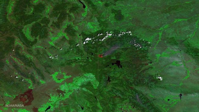
Maple fire threatens Western edge of Yellowstone National Park
The instrument uses multiple channels, including visible and thermal imagery, to distinguish cloud, smoke, land, and areas of active fires.
A large fire's thermal signature is so strong, and burns area so large, that it is easily detected by the satellite's sensors 512 miles above the Earth's surface, read the NASA website.
According to the joint agency incident information system website, Inciweb, the 22,448-acre Maple Fire (just one of the blazes in the Tatanka Fire Complex) was detected the evening of August 8 by an aircraft passing over Yellowstone National Park.
The fire remains 4 miles east of the Park's west boundary, and 5 miles northeast of the community of West Yellowstone and 2.8 miles from Madison Junction.
Currently 22,448 acres, the Maple Fire grew an additional 6,233 acres yesterday. An infrared mapping flight was conducted last night and the majority of the new growth was on the northern flanks of the fire.
Credit: NOAA Environmental Visualization Laboratory/NASA
Support Our Journalism
We cannot do without you.. your contribution supports unbiased journalism
IBNS is not driven by any ism- not wokeism, not racism, not skewed secularism, not hyper right-wing or left liberal ideals, nor by any hardline religious beliefs or hyper nationalism. We want to serve you good old objective news, as they are. We do not judge or preach. We let people decide for themselves. We only try to present factual and well-sourced news.
Support objective journalism for a small contribution.