

 Asani
Asani
Severe cyclonic storm 'Asani' now weakens into cyclonic storm: IMD
Hyderabad: The Severe Cyclonic Storm 'Asani' (pronounced as Asani) over west-central Bay of Bengal moved west-north-westwards with a speed of 12 kmph during the past six hours, weakened into a Cyclonic Storm on Wednesday.
It now lay centered at 0230 hours on Wednesday over same region near latitude 15.6°N and longitude 81.3°E, about 60 km south-southeast of Machilipatnam (Andhra Pradesh), 180 km south-southwest of Kakinada (Andhra Pradesh), 310 km southwest of Visakhapatnam (Andhra Pradesh), 550 km south-southwest of Gopalpur (Odisha) and 660 km southwest of Puri (Odisha).
It is very likely to move nearly northwestwards for next few hours and reach Westcentral Bay of Bengal close to Andhra Pradesh coast, India Meteorological Department (IMD) said in a bulletin this morning.
CS ASANI lay centered at 0530 hrs IST, near lat 15.8°N & long 81.4°E, about 40 km south of Machilipatnam. Likely to move nearly northwards for next few hour & recurve slowly NNEwards & emerge into westcentral BoB off North AP coasts by night. pic.twitter.com/iIu49NLkhc
— India Meteorological Department (@Indiametdept) May 11, 2022
It said thereafter, the Cyclonic storm is very likely to recurve slowly north-northeastwards, move along Machilipatnam, Narsapur, Yanam, Kakinada, Tuni & Visakhapatnam coasts and emerge into west-central Bay of Bengal off North Andhra Pradesh coasts by today evening.
Then it is likely to move north-eastwards towards northwest Bay of Bengal. It is likely to weaken gradually into a depression by Thursday morning, the bulletin said.
Light to moderate rainfall at most places with heavy to very heavy rainfall at a few places with isolated extremely heavy falls is likely over coastal Andhra Pradesh today.
#CycloneAsani #Update
— NDRF 🇮🇳 (@NDRFHQ) May 10, 2022
🔶#NDRF Deployment
🔶50 Teams committed across
🔶Andhra Pradesh
🔶Odisha &
🔶West Bengal#BePreparedBeSafe#Committed2Serve🙏🙏#आपदासेवासदैवसर्वत्र 🇮🇳@PMOIndia@HMOIndia@BhallaAjay26@AtulKarwal@ndmaindia@PIBHomeAffairs@ANI@airnewsalerts pic.twitter.com/FOfXlOLNbK
Gale wind speed reaching 80-90 kmph gusting to 100 kmph is prevailing around the system center over west-central Bay of Bengal.
It would gradually decrease and become 60-70 Kmph gusting to 80 Kmph by this evening over the same region. Further, it would decrease to 40-50 Kmph gusting to 60 Kmph over west-central Bay of Bengal on May 12.
Squally wind speed reaching 55-65 kmph gusting to 75 kmph is prevailing along and off Andhra Pradesh coast. It is likely to increase and become gale wind speed reaching 70-80 kmph gusting to 90 kmph in the morning hours of May 11 along & off Andhra Pradesh coast (Krishna, East & West Godavari, Yanam of Puducherry UT and Visakhapatnam districts) and further, it would decrease to 45-55 Kmph gusting to 65 Kmph over the region.
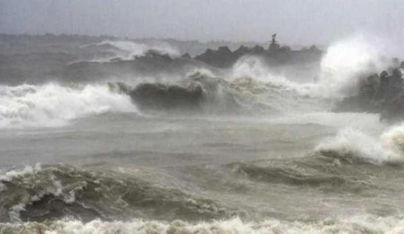
Sea condition is likely to be high over west-central & adjoining northwest Bay of Bengal on 11th May and very rough to rough over the same region on 12th May.
Storm surge of height about 0.6 m above astronomical tide is likely to inundate low lying areas of Krishna, East & West Godavari, Yanam of Puducherry UT and Vishakhapatnam districts of Andhra Pradesh.
There will be damage in Krishna, East & West Godavari, Yanam of Puducherry UT and Vishakhapatnam districts of Andhra Pradesh due to the Cyclonic storm. There will be damage to thatched huts, Minor damage to power and communication lines due to breaking of tree branches, Major damage to Kutcha and minor damage to Pucca roads.
There will be also damage to paddy and other standing crops, banana, papaya trees and orchards, the bulletin said.
(With UNI inputs)
Support Our Journalism
We cannot do without you.. your contribution supports unbiased journalism
IBNS is not driven by any ism- not wokeism, not racism, not skewed secularism, not hyper right-wing or left liberal ideals, nor by any hardline religious beliefs or hyper nationalism. We want to serve you good old objective news, as they are. We do not judge or preach. We let people decide for themselves. We only try to present factual and well-sourced news.
Support objective journalism for a small contribution.