September 14, 2026 11:25 pm (IST)
Follow us:
facebook-white sharing button
twitter-white sharing button
instagram-white sharing button
youtube-white sharing button
Gurugram horror caught on camera: ‘I felt unsafe’—car chases, rams woman biker and flees | BRICS veg menu row: ‘Why shouldn’t we showcase it?’—Harsh Goenka hits back after Rahul Gandhi’s ‘80%’ remark | India-UAE Comprehensive Strategic Partnership in focus: Modi meets Abu Dhabi Crown Prince on BRICS sidelines | Xi Jinping lands in India for BRICS; big Modi meeting set for New Delhi | ‘Hospitality on another level’: South African official stunned by India’s BRICS hosting | Suvendu Adhikari eats fish bhog at Kalighat Temple amid Bageshwar Baba row | Bangladeshi Hindu monk Chinmoy Krishna Das breaks down emotionally as he gets 5-hour parole to attend mother’s funeral | Sheikh Hasina’s daughter Saima Wazed quits WHO post amid fraud allegations | After days of silence, China confirms Xi Jinping’s India visit for BRICS Summit | Big setback for Abhishek Banerjee as CID arrests aide Sumit Roy

Minister informs Lok Sabha about satellite mapping of ASI monuments

| | Mar 14, 2016, at 09:48 pm
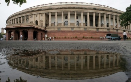
New Delhi, Mar 14 (IBNS) Minister of State for Culture and Tourism (Independent Charge) and Minister of State for Civil Aviation Dr. Mahesh Sharma in a written reply in Lok Sabha on Monday said, that the Archaeological Survey of India (ASI) entered into a Memorandum of Understanding (MoU) with National Remote Sensing Centre, Indian Space Research Organization (ISRO) for preparation of satellite based maps for the protected monuments.

The map will indicate prohibited and regulated areas clearly for the information of public and also to facilitate procedure for grant of permissions for construction-related activity within prohibited and regulated areas of all the 3,686 centrally protected monuments.

The minister said ISRO has a repository of photographs of various monuments/sites that have been taken at periodic intervals. Using these photographs that are taken routinely through satellites over a period of time and combining them with the map-plotted boundaries of plots for which permissions under AMASR Act have been given, a surveillance system is within the realm of technological possibility. 

Support Our Journalism

We cannot do without you.. your contribution supports unbiased journalism

IBNS is not driven by any ism- not wokeism, not racism, not skewed secularism, not hyper right-wing or left liberal ideals, nor by any hardline religious beliefs or hyper nationalism. We want to serve you good old objective news, as they are. We do not judge or preach. We let people decide for themselves. We only try to present factual and well-sourced news.


Support objective journalism for a small contribution.